Construction surveying using drones instead of construction profiles
During the Building Appeals Court’s on-site inspection of the Oberer Deutweg development plan in Winterthur, it quickly became clear that traditional construction sightlines would reach their limits for this project. Limited space, public areas, and the high cost of a conventional construction profile made an alternative solution necessary. This is exactly where our drone technology came into play.
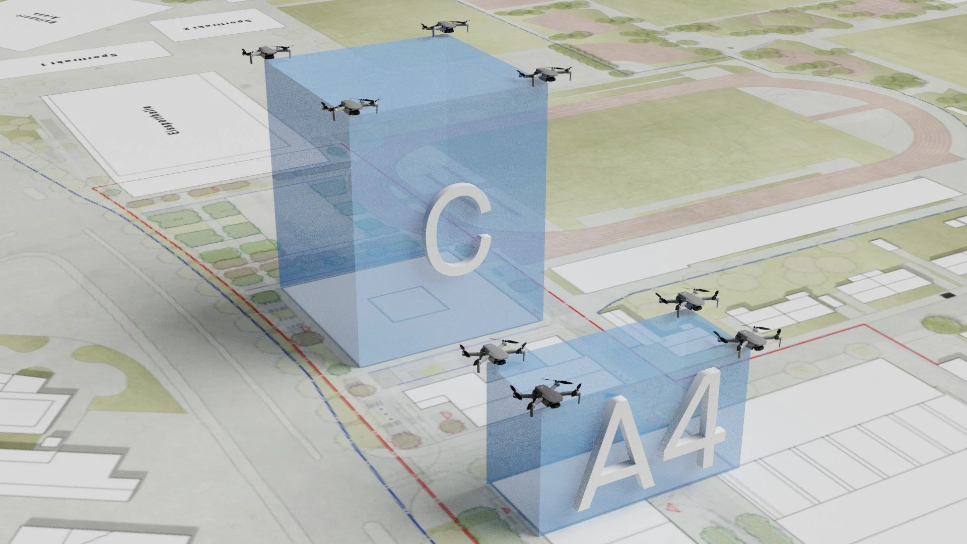
Instead of erecting massive steel structures or construction frameworks, we visualized the future building volumes in the space itself using six drones flying simultaneously. The drones positioned themselves precisely at the imaginary corners of the planned structures in construction zones C and A3. This created a precise spatial representation of the future architecture on site.
It immediately became clear to everyone involved how the planned buildings would fit into the existing surroundings in terms of height, volume, and scale. That is precisely what matters during a site visit. Plans and renderings on paper often only give a limited sense of a project’s actual impact. A drone-based construction visualization, on the other hand, allows architecture to be experienced directly in the real world.
The project clearly demonstrated the advantages of using a construction sighting system with drones over traditional construction profiles. There was no need to cordon off any areas, and public spaces remained virtually unrestricted. At the same time, it eliminated the need for complex installations, material transport, and installation work lasting several days.
This method also offers significant economic advantages. A drone-based construction visualization system can be implemented much more quickly and reduces costs for materials, logistics, and personnel. Especially for complex properties, urban sites, or sensitive areas, this technology opens up entirely new possibilities for construction visualization.
Technically, the operation was challenging. Six drones maintained their positions in the air with stability and precision for over an hour. Each drone marked a specific corner of the future buildings, making the planned volume immediately visible.
Today, more and more architects, project developers, urban planners, and building owners are looking for flexible alternatives to traditional surveying methods. Especially in situations where conventional surveying is either extremely difficult or impossible to carry out, drones offer a modern and efficient solution.
The project in Winterthur demonstrates how construction visualization can be reimagined—more precise, more efficient, and significantly more flexible than previous methods. The future of construction visualization is no longer taking shape on the ground, but in the air.